By deploying drone photogrammetry and As-Built Scanning, the project team was able to quickly remap the site, identify problem areas, and implement corrective measures within days—saving an estimated $15,000 in potential rework costs and keeping the project on schedule.
In the fast-paced world of Architecture, Engineering, and Construction (AEC), efficiency, precision, and timely delivery are essential to the success of any project. With increasing demands for faster construction times and tighter budgets, technology is pivotal in enabling professionals to meet these challenges. One of the most transformative technologies in recent years has been Reality Capture—the process of using advanced scanning tools to create accurate, data-rich 3D models of physical environments. By leveraging tools such as LiDAR, drones, and photogrammetry, AEC professionals are significantly improving project outcomes in terms of cost, quality, and delivery.
Cost Efficiency through Automation and Accuracy
One of the most significant advantages of Reality Capture is its ability to streamline traditional, labor-intensive documentation processes. Traditional site surveys and documentation require considerable time, effort, and manual labor. Teams must spend days or even weeks capturing measurements, mapping out terrain, and drawing up detailed site plans.
Reality Capture technologies like As-Built Scanning and drone photogrammetry provide a faster, more accurate alternative. Using advanced sensors and software, these technologies can capture comprehensive spatial data in hours, dramatically reducing the time required for documentation and minimizing the need for manual measurements. The data gathered is highly accurate, ensuring that project teams work with precise, reliable information from the outset.
Moreover, project managers can easily compare real-world conditions with design plans by creating a digital 3D model or point cloud of the site. This allows them to spot discrepancies early in the process, before they become significant issues. For example, if a site feature like a foundation footer is slightly out of position, this can be detected in the early stages using Reality Capture, saving time and preventing expensive mistakes down the line.
Regular site scans throughout the project lifecycle also enable teams to monitor progress accurately, providing an additional layer of cost control. Early detection of potential issues, such as misaligned structures or unanticipated terrain features, allows project teams to make timely adjustments, reducing the risk of budget overruns.
Cost Efficiency in Action:
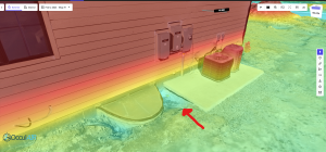
Consider a construction project in Indiana that faced potential delays due to inaccurate ground-level measurements. By deploying drone photogrammetry and As-Built Scanning, the project team was able to quickly remap the site, identify problem areas, and implement corrective measures within days—saving an estimated $15,000 in potential rework costs and keeping the project on schedule.
Improved Quality Control and Reduced Errors
Construction projects often face quality issues due to inaccuracies in design and execution. Whether it’s a minor deviation in the positioning of structural elements or a larger problem like uneven terrain affecting building foundations, small errors can escalate into significant issues if not detected early. This is where Reality Capture plays a critical role in enhancing quality control.
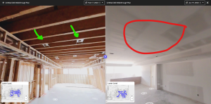
Using tools like LiDAR and 3D laser scanning, teams can capture as-built conditions with unparalleled accuracy, creating a digital replica of the physical environment. These digital models can then be compared against the original BIM (Building Information Modeling) or CAD designs to ensure that construction proceeds according to plan. By regularly capturing data, teams can perform real-time progress assessments, detecting deviations from design specifications.
For example, if a wall or support structure is slightly out of alignment, this discrepancy can be identified immediately using Reality Capture tools. Project teams can address the issue before it compounds, ensuring that all elements of the build meet the necessary quality standards. This not only improves the overall quality of the project but also boosts client satisfaction by ensuring that the final product matches their expectations.
Additionally, by maintaining a digital record of the entire project, teams can provide stakeholders with detailed progress reports and visual documentation at every stage. This builds transparency and trust while offering a valuable resource for post-construction maintenance or future renovations.
Example of Quality Improvement:
In a project in Fort Wayne, we were able to use orthomosaic photogrammetry overlayed with 2D floor plans to identify plumbing location errors prior to pouring concrete. We complete a drone scan of the site before infrastructure items like electrical and plumbing are encapsulated in concrete. With an orthomosaic of these items exposed we can overlay a 2D drawing and ensure they are both present and in the correct locations.
Faster Project Delivery and Enhanced Coordination
Time is one of the most valuable resources in construction, and Reality Capture significantly enhances project delivery speed by reducing time-consuming manual tasks and allowing faster decision-making. In traditional construction workflows, gathering the necessary data from field surveys can take days or weeks, which delays subsequent phases of the project. By contrast, Reality Capture technologies like drone-based photogrammetry and 3D scanning can complete this process in a fraction of the time.
With real-time data capture, project teams can access up-to-date site information instantly, enabling them to make informed decisions without waiting for manual survey reports. This reduces bottlenecks and ensures that all stakeholders are working with the most accurate, up-to-date information, minimizing the risk of miscommunication.
Additionally, by integrating Reality Capture into BIM workflows, project teams can simulate the entire construction process virtually before breaking ground. This allows for the early identification of potential issues, such as design clashes or terrain obstacles, which can be addressed before they cause delays. By aligning the virtual model with the real-world site data, BIM tools help streamline planning, coordination, and execution, accelerating the overall project timeline.
Impact on Delivery Time:
In a recent infrastructure project, using Reality Capture reduced project timelines by 20%. The team used drone photogrammetry to create highly accurate maps of a complex, multi-level site, allowing them to anticipate construction challenges early and adjust the design without delaying execution.
Enhanced Stakeholder Communication
Another key benefit of Reality Capture technologies is their ability to improve communication and collaboration among project stakeholders. By creating highly detailed, data-rich construction site models, teams can share this information with architects, engineers, contractors, and clients. These models visually represent the project, allowing all parties to see and understand the site’s conditions and progress in real-time.
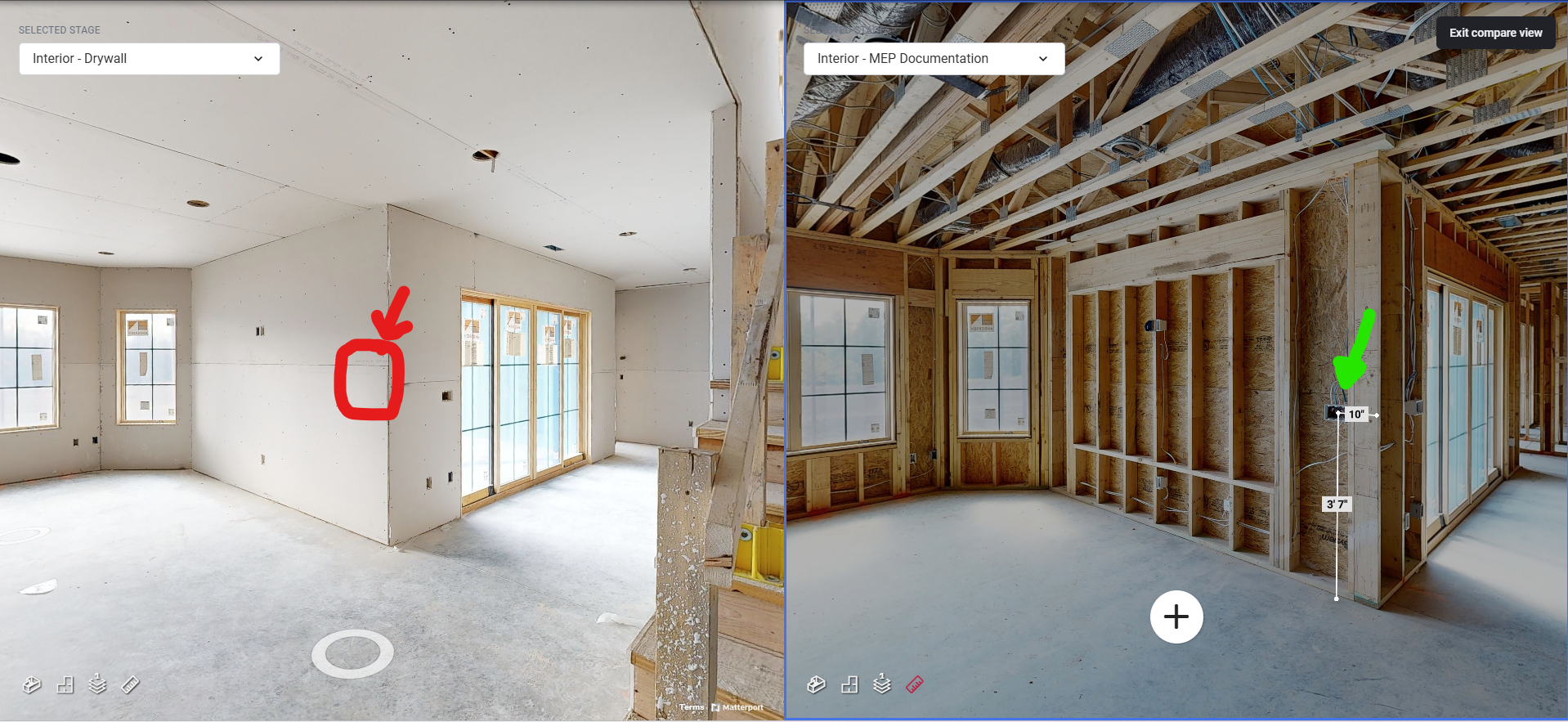
This level of detail helps to bridge the communication gap between technical experts and non-technical stakeholders, ensuring that everyone is aligned on the project’s goals and milestones. For instance, a client or investor can “walk through” the construction site using a 360-degree virtual tour, allowing them to provide feedback and ask questions without needing to be physically present.
This real-time, visual communication helps to avoid misunderstandings and keeps all stakeholders engaged and informed, further accelerating decision-making and project timelines.
In the competitive AEC industry, Reality Capture technologies are proving to be invaluable tools for improving cost efficiency, ensuring high-quality outcomes, and speeding up project delivery. By integrating tools like LiDAR, 3D laser scanning, and drone photogrammetry into the construction process, project teams can significantly reduce errors, streamline workflows, and improve communication with stakeholders.
For AEC professionals looking to gain an edge in today’s market, adopting Reality Capture technologies is no longer an option—it’s a necessity. By reducing errors, enhancing quality, and ensuring timely project delivery, these technologies are transforming the way construction projects are managed and executed, leading to better outcomes for everyone involved.


