In modern construction and infrastructure development, the need for precise planning and collaboration has never been greater. Reality Capture technologies such as LiDAR scanning, photogrammetry, and 3D scanning have become critical tools for enhancing Building Information Modeling (BIM) workflows.
In modern construction and infrastructure development, the need for precise planning and collaboration has never been greater. Reality Capture technologies such as LiDAR scanning, photogrammetry, and 3D scanning have become critical tools for enhancing Building Information Modeling (BIM) workflows. These technologies bridge the gap between the physical and digital worlds, providing highly accurate data that improves project coordination and reduces errors throughout the construction lifecycle.
What is Reality Capture in Construction?
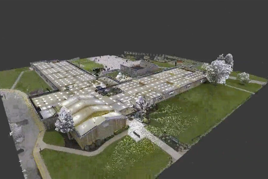
Reality Capture refers to the process of using advanced technologies like LiDAR scanning and photogrammetry to create detailed 3D representations of physical spaces. This data can be seamlessly integrated into BIM models, providing a highly accurate digital twin of a construction site or building.
Technologies commonly used for Reality Capture include:
- LiDAR Scanning: Uses laser pulses to generate precise point clouds for detailed site mapping.
- Photogrammetry: Captures 3D data through high-resolution images taken from drones.
- 3D Laser Scanning: Captures complex geometries and structures with exceptional accuracy.
The Role of Reality Capture in BIM Workflows
Integrating Reality Capture with BIM ensures a more efficient design and construction process by improving accuracy and collaboration between stakeholders.
1. Enhanced Data Accuracy for BIM Models
Reality Capture provides high-fidelity 3D data that can be directly imported into BIM software. This real-world data ensures that BIM models reflect actual site conditions, reducing the risk of discrepancies between digital plans and physical reality.
- Minimized Measurement Errors: LiDAR and photogrammetry data improve precision, reducing manual measurement mistakes.
- Accurate Site Representation: Capture complex structures and terrain features accurately, even in challenging environments.
2. Improved Coordination and Collaboration
By integrating Reality Capture data into BIM models, all stakeholders—architects, engineers, and contractors—work from a single, accurate model.
- Clash Detection: Early identification of design conflicts before construction begins.
- Remote Collaboration: Teams can review site data remotely, reducing the need for physical site visits.
- Centralized Data Sharing: Sharing point cloud data ensures all teams have access to the same information.
3. Streamlined Construction Progress Tracking
Reality Capture helps teams monitor construction progress in real-time by comparing current site data with the original BIM models.
- Progress Verification: Confirm construction phases align with the original design.
- Reduced Rework: Early identification of deviations minimizes costly rework.
Applications of Reality Capture in BIM Workflows
Reality Capture technology is beneficial at multiple stages of the construction process, including:
- Pre-Construction Site Analysis: Capture existing conditions before design begins.
- Construction Phase: Monitor progress and ensure project alignment.
- Post-Construction and Facility Management: Provide detailed as-built documentation for long-term use.
The integration of Reality Capture with BIM workflows is transforming how construction projects are managed. By providing highly accurate data from the start, these technologies ensure better decision-making, fewer errors, and improved collaboration across all project phases.